 |
As we pull off of Lake Michigan we go under a series of 7 bridges through down town Chicago. These bridges open for one weekend every Spring and Fall to allow larger boats on and off lake, and for emergencies. There has not been an Emergency that has required them to open in 25 years. They are staffed 24 /365 just in case they have one.  This and next few shots are of downtown Chicago   These are petroleum pipes going over canal  |
Our first river barge fairly small, We thought it was large at time. It is 3 wide by two long the bigest we will see is 7 X 7


 |
Exiting a lock to find barges coming in. |
 |
Barges are scary and you can wait along time for them but the crews are usually friendly.  This is the same barge as previous two pictures heading in. You always have to be careful around Tows. The wash from props when they accelerate can move you 20 ft and spin you around 180 in seconds. This one was not bad.  |
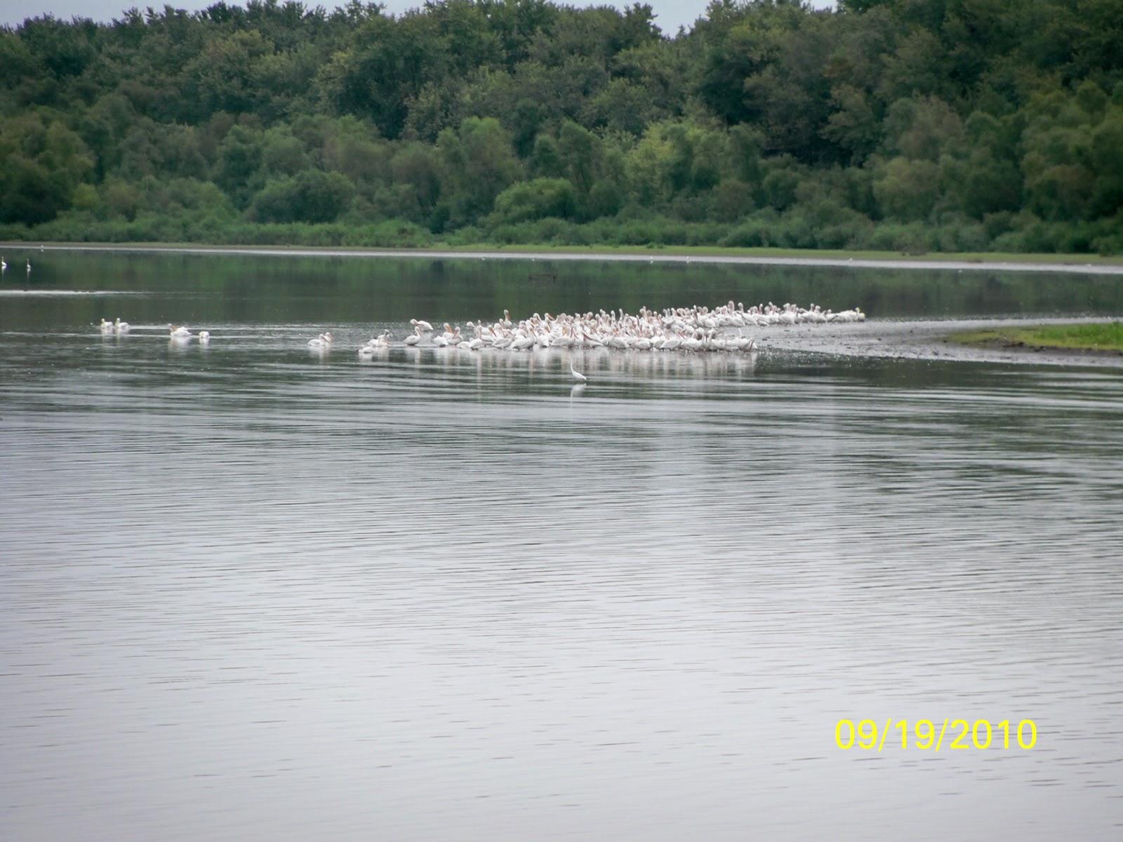 |
First Flock of Migrating White Pelicans They Migrate from Hudson bay to Texas every year we are now on Illinois river. |

 |
In Flight |
 |
The scenery never failed to amaze us. The current cut our fuel usage considerably, notice ATON in foreground. |
 |
This is in Grafton at Junction of Illinois and Mississippi Notice red sign with line showing high water mark from 1993 Flood. The water behind building is 10 ft above normal pool and 1 ft below flood stage. |
 |
This is the first day on the Mississippi. Though we read extensively about Miss., we were still amazed every day about the beauty and uniqueness to river. |

 |
More white pelicans on Mississippi |
 |
Approaching St Louis in Chain of Rocks Canal |
 |
We were nervous about doing Miss. With just Joan and I so Bernie flew into St Louis to join us. This is the first lock in Rock Canal. |
 |
5X 3 barge In Rock Canal, longest so far. Barges are 180 to 220 ft long, 60 wide. Through this section the barges were only 3 wide because of lock limitations. |
 |
Lots of coal for power plants. |
 |
| Miss was 10 to 12 ft over normal pool. 6 to 9 mph of current. We were moving! |
 |
First view of the arch. Water front is very industrial for 50 miles around St Louis there are no recreational marinas. Not a single place to stop or buy food or fuel. If you are on a boat you cannot go ashore to see the Arch. |


 |
Yes, the Mississippi is muddy. |
 |
This is a similar picture in the Ohio River. In the Ohio you could not see the forth rung of our boarding ladder when it was in the water. In the Mississippi you couldn’t see any rungs. My criteria for swimming are you have to see the bottom rung and it has to look silver. |
 |
| Tied up at Hoppie’s . This is the only recreational facility from north of St Louis to the Ohio River. 235 Miles. Hoppie’s first job on the river was as a lantern lighter. Every night he went up and down river lighting and maintaining the lanterns in light houses. Fran ran an informational session on how to navigate the river for all the Loopers that stopped here. Very helpful! We walked into town and ate at the famous Blue Owl. Bought some mile high apple pie with caramel topping. Yum! We waited till 10 AM for fog to clear the next morning to get underway. |
 |
| 3 Engine tug pushing a 6 wide barges I do not remember how long. This tug is 300 ft long by 80 wide and has 4000 to 5000 HP per engine. |
 |
The tugs do not pay much attention to river debris, they can’t, but with the floods trees were a constant problem and we saw many different items like refrigerators, truck axils with 4 wheels attached floating in the river. |

 |
Picture gives good indication of the size of barges. |
 |
Good picture of 5X7 barges |
 |
Good picture of 5X7 barges |

 |
Ohio river, This is approach to Ohio from Miss. This is a major area for reconfiguring barges. From here south on the Mississippi there are no locks so there are no physical limit to barge size. The Cumberland river, Ohio, Tennessee Missouri and Illinois all join within 200 miles of this point. There are 100s of barges that are taken apart here and reformed for there journey to other cities. More freight moves through this point than the ten biggest rail yards in the United States combined. |
 |
The blue water is the Ohio, brown Mississippi |
 |
Sunset in Metropolis |
 |
City of Paducah Kentucky: This city is surrounded by 12 foot walls to protect the city from floods which use to devastate the city. The walls were built while the Kentucky and Cumberland dams were being built. The water has never come close to the walls after the dams were finished. |
 |
This is a three engine tug in dry dock. Note the men working on the props |
 |
Bernie is working real hard helping us out. Actually this was at the entrance to the Kentucky Lock where we anchored and waited for 5 hrs for two sets of barges to clear lock. This relaxing stuff is tough work but someone has to do it. |
 |
We are now in Kentucky Lock we exit we will be in Kentucky Lake. |
 |
The Gates open we are in Kentucky Lake. Just a small set of barges waiting for the lock blocking the view. |
No comments:
Post a Comment